
Supercell Storms Forecast for New South Wales as Lightning Leaves Swimmer in Serious Condition
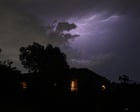
Dangerous 'supercell' thunderstorms capable of giant hail and destructive winds were forecast for parts of New South Wales on Sunday, as volatile weather continued across Australia's eastern states over the weekend.
Storms on Saturday dumped heavy rain across large parts of northern and eastern New South Wales and much of Queensland. Strong winds of up to 98km/h were recorded in Goulburn, and rainfall totals of between 30mm and 50mm fell in the Coffs Harbour area.
On Saturday afternoon, a man in his 20s was struck by lightning while swimming at Ettalong beach on the New South Wales Central Coast. Fellow swimmers pulled him from the water and he was given CPR by first responders until New South Wales Ambulance paramedics arrived.
The young man was taken to Gosford hospital in a serious condition and later transferred to Royal North Shore hospital. A hospital spokesperson said that on Sunday morning he was in a critical but stable condition.
Witnesses said that while storm activity was visible in the distance towards Gosford, the area around the beach was clear and sunny, and the lightning bolt appeared to come 'out of nowhere'. Lightning can strike up to 30km from the centre of a storm cell.
Sunday was expected to be 'another big storm day', with 'very dangerous and severe thunderstorms' likely for north-eastern New South Wales, said Sarah Scully, a senior meteorologist at the Bureau of Meteorology.
Those storms could bring hail with a diameter greater than 5cm and winds in excess of 120km/h, Scully said. 'That's being driven by a southerly change that's pushing up the New South Wales coast,' she said. 'It's a potential trigger for these supercell high-end thunderstorms.'
Severe thunderstorms were also possible on Sunday through a broader area, extending down towards inland parts of the ranges to the east of Sydney and pushing up into south-east and central Queensland, with 2cm hail, wind gusts in excess of 90km/h, heavy rainfall and flash flooding. Storms were expected in Sydney on Sunday but were likely to be less severe, with rain likely and a forecast temperature of 23C. Brisbane was expecting showers and thunderstorms with a top of 31C.
On Monday, the risk of high-end severe thunderstorms would move into the New South Wales northern rivers and south-eastern Queensland, including Brisbane, the Gold Coast and the Sunshine Coast, again with the potential for giant hail, destructive winds and intense rain that could lead to life-threatening flash flooding.
Scully said that risk was again being driven by the trough pushing up the coast, combined with the very humid conditions eastern Australia had been experiencing over the previous few days.
A coastal trough with a low-pressure system appeared to be developing off the north coast of New South Wales near the Queensland border, with the potential to bring even more rain onto the coast. Scully said moderate rainfall totals of between 30mm and 70mm were expected on Monday from the coastal trough, easing into Tuesday morning, but that totals depended on how close the trough sat to the coast and how long it lingered there, and that rainfall from such coastal troughs is notoriously challenging to predict.
Elsewhere on Sunday, Melbourne was expecting showers with a top of 17C, Hobart had a high chance of showers with 13C expected, Adelaide was forecast cloudy and mild at 20C, Canberra partly cloudy at 24C and Perth partly cloudy at 28C. Darwin was expecting 34C and an afternoon storm.
The Bureau of Meteorology expected to release more severe weather warnings throughout Sunday as the storms developed.